
A member of


2026 V2X Award winner

Digitize the rules of the road and transform the way your city flows
A trusted digital twin of your network does more than improve operations. It becomes the foundation for Vision Zero, network resilience and a more connected city.
Digitize the rules of the road and transform the way your city flows
A trusted digital twin of your network does more than improve operations. It becomes the foundation for Vision Zero, network resilience and a more connected city.
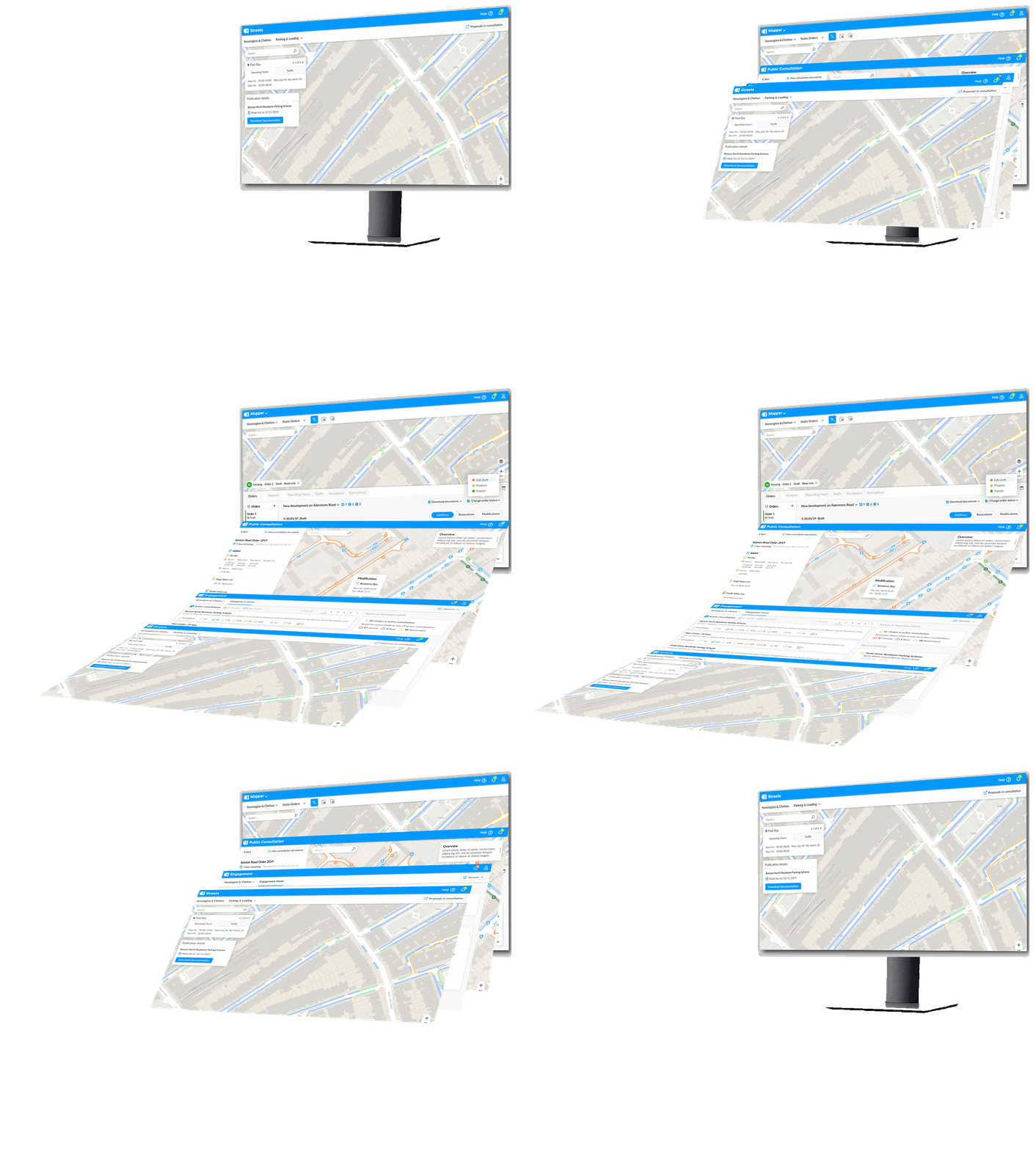
All in one place
Unlock your road network’s true potential by managing Curb Rules, Roadway Rules, and Event Closures.
For many cities, the road network is a complex and neglected asset. Without a true, data-driven understanding, you can’t create effective policies for enforcement, new mobility, or revenue generation.
Network resilience depends on it too. When a storm, flood or bridge strike hits, change restrictions once and every connected system sees the update. Then restore normal rules just as fast.

Great policy requires great data
We’ve mapped over 28,000 miles of network (enough to circle the world!) from your data or our own capture. Machine-readable rules mean Vision Zero work goes where it’s needed most.

Automate workflow and free up time for more critical work
Move from policy to action faster by automating complex processes. This cuts manual costs by over 40% and allows your staff to stop managing regulations and start managing outcomes that matter

Manage and monetize your assets like never before
From granular management of commercial loading zones to enabling seamless cashless payments, our platform helps you create new revenue opportunities that citizens are happy to use.

Future of mobility
Where can a robotaxi legally stop right now? And for how long?
A robotaxi can’t tell if it can legally stop at the curb. No map, sign or camera shows that. AppyWay’s curbside API does. It takes the unknown out of journey planning and adds last-meter intelligence for first-time-right arrivals.

Pickup and drop-off
Pickup and drop-off points are chosen because they’re legally allowed, not guessed at.

Less deadheading
Fewer wasted trips repositioning to find a legal parking spot.

Less time at the curb
Faster first-time-right arrivals, shorter time waiting at the curb, and fewer parking tickets.

Clear of bus and bike lanes
Avoids bus and bike lane conflict and reroutes dynamically toward compliant curb space.
Trusted by forward-thinking cities and partners for 10+ years



Data aggregation
Zero road deaths needs one source of truth
Cities work with many camera and sensor providers. AppyWay is IoT-agnostic and maps their data against your curb rules. Find high-injury corridors, update rules in one place and measure the impact for your Safety Action Plan. The policy layer for safer streets, built for Vision Zero.

Case Study

Modernizing New York's Curb
* Demonstrated a scalable curbside management solution
* Overcame fragmented data and manual processes
* Provided a detailed roadmap for citywide application
* Laid foundations for smarter urban planning and safety
99%
Data accuracy
42.6%
Improved operational efficiency for NYC DOT users
API-ready
Curb inventory for analysis and integration
One platform, a single source of truth for your entire road network
Manage your curb rules, roadway rules, and event closures, all in a clear, simple interface.

Mapper
Digitize & Map Your Network
Create Your Curb's Digital Twin
Transform your curb policies into machine-readable, geo-accurate data.
Achieve over 90% accuracy
Eliminate manual processes with a single source of truth.
Visualize curb availability
Visualize curb space availability by time of day and restriction type.

Consultation & Review
Public Engagement
Enable Digital Consultations
Use digital tools to consult with your community on proposed changes, making planning more inclusive.
Gather Geospatial Feedback
Allow residents to provide direct, location-based feedback to inform safer, more equitable street designs.
Accelerate Policy Rollouts
Turn weeks of manual consultation and mapping into hours, speeding up the implementation of new pilots and programs.


KurBI
Intelligent curb reporting
Access Curbside Analytics
Use powerful analytics dashboards to understand curb usage and support evidence-based policymaking.
Monitor progress
Monitor the distribution of curb innovations across neighborhoods to ensure allocations are fair and equitable.
Model Policy Impacts
Use data to model the potential impacts of new policies, safety outcomes, sustainability metrics, and mobility schemes before implementation.

API Solutions
Connect Your Data to the World
Integrate with Existing Systems
Provide seamless integration with your existing DOT and GIS systems.
Power a Connected Ecosystem
Enable third-party operators, logistics companies, and consumer navigation apps to access your rules, improving efficiency and compliance across the city. When disruption hits, everyone works from the same up-to-date rules.
Power Intelligent Enforcement
Link ANPR and enforcement cameras to our dynamic database to improve enforcement accuracy and prevent revenue leakage.

Featured on


See how we're putting policy into action
Sign up to our newsletter
Keep up to date on the latest news and insights on smart cities, intelligent parking, and more!

Ready to build
a smarter city?
Get in touch for a personalized demo with our curb management specialists to see how it all connects.
