Traffic orders made easy for the public, Streets visualises traffic order data in a user-friendly interactive map. Searchable and interactive, share traffic order information with ease.

Transparent and user-friendly review of traffic orders
Request more infoPlay Video
Watch a 1 minute demo
Demonstration
Traffic orders visualised and made easy for the public
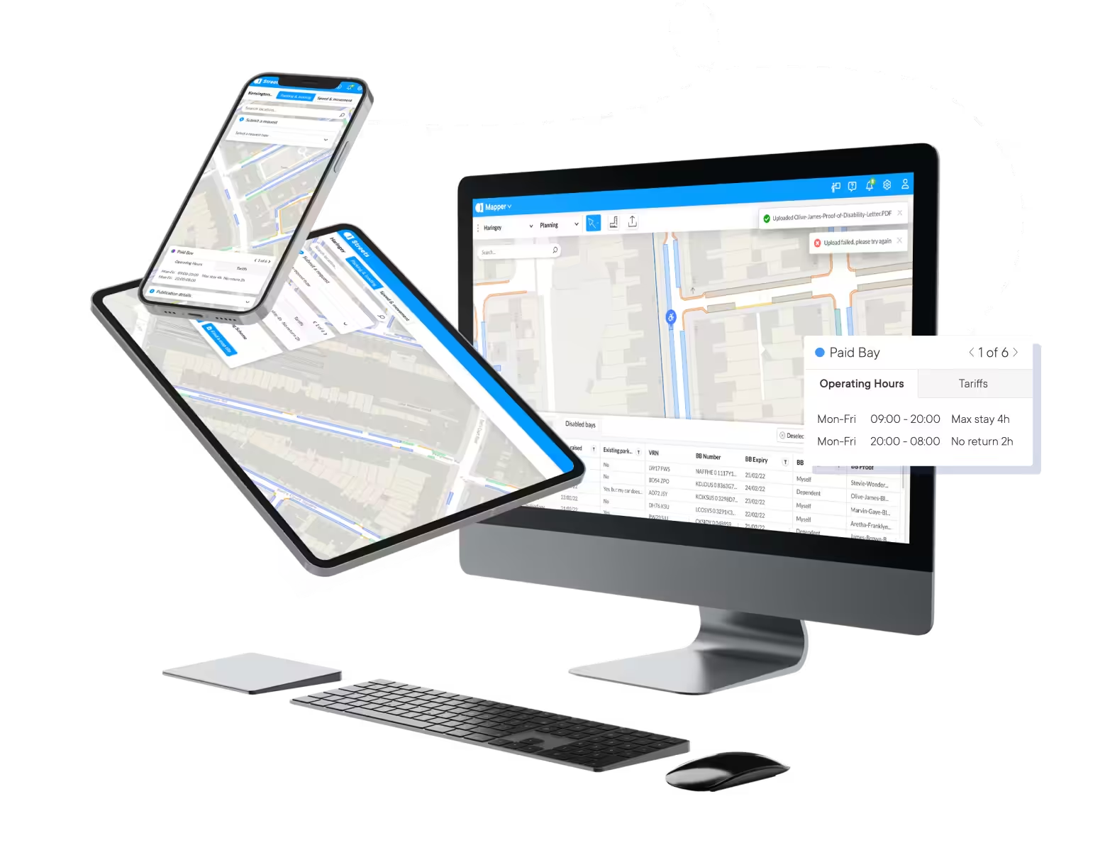
Interactive, authority-wide map of active on-street restrictions for easy public access.
Grow public trust with open data
Maximise transparency and visibility of traffic order data, making it easy for the public to review.
- Public requests: Manage incoming requests through a standardised form, decision log and notifications
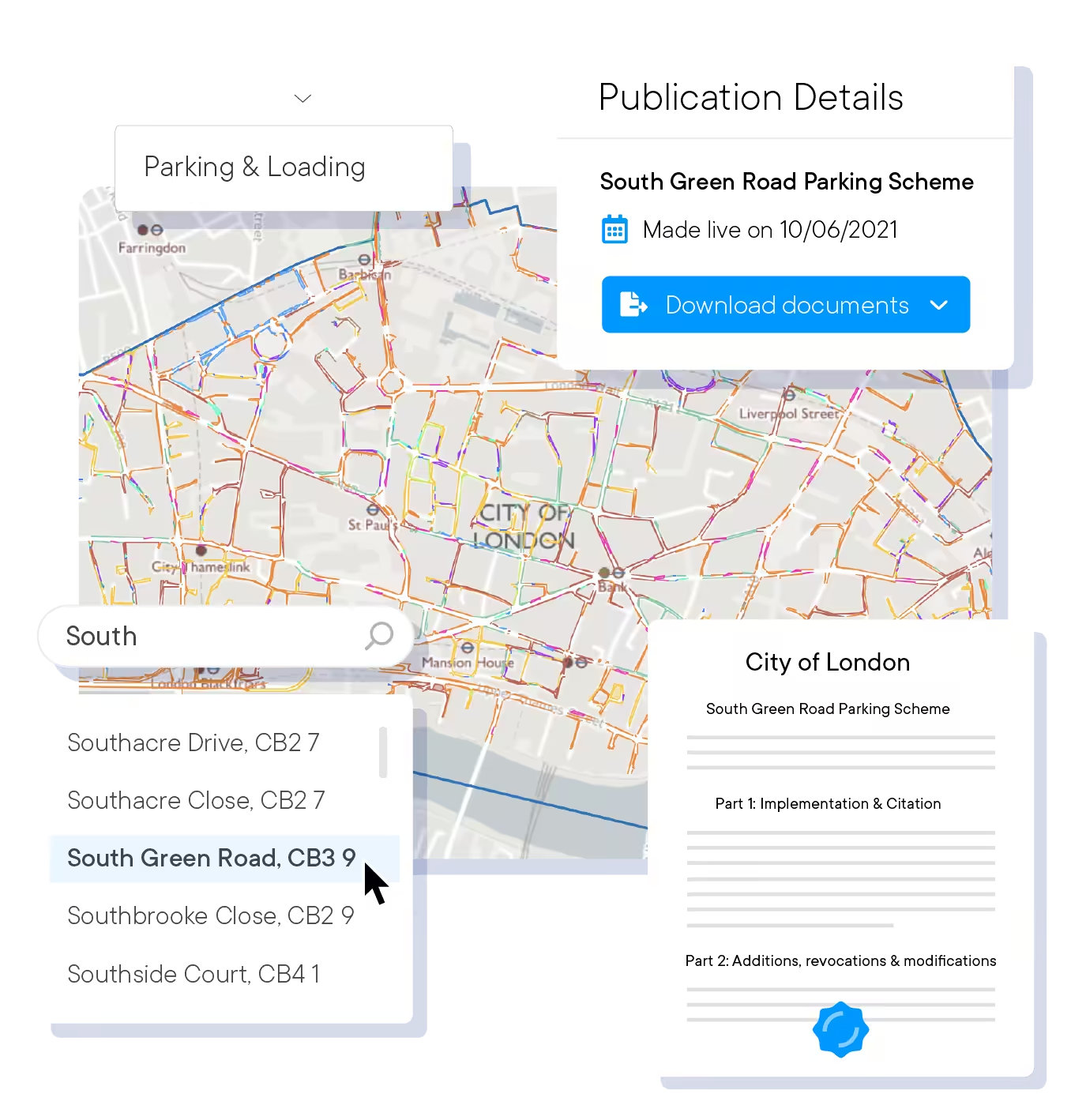
- Online: Provide easy access to completed traffic order whenever and wherever the public wants
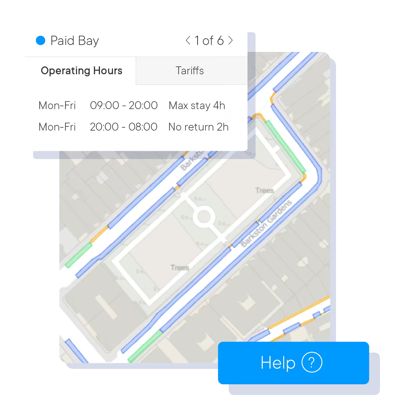
- Help: Make it simple for the public to ask for support directly on the platform
Drive public understanding of traffic restrictions
Interactive map view standardised with several layers of detail for easy review.
- Traffic orders: Synchronise authority wide display of completed traffic orders automatically
- Parking information: Allow the public to make better parking decisions with open data
- Self service: Reduce freedom of information requests coming in to the authority
Demo
Experience Streets for yourself


https://www.youtube.com/watch?v=6oTurM7gESE
Customer Stories
Streets – Driving efficiencies beyond the core traffic order team
0:31 duration
Surveys
We deliver speed and accuracy at half the cost of traditional surveys
Our expertise in reducing the gap between what’s on the road and in records is why local authorities pick us for digitising their traffic orders.
360° Imagery
Specialised vehicle-mounted cameras capture high definition photographs every meter to ensure high accuracy and coverage of roads.
Pinpoint Accuracy
All imagery is date and timestamped, whilst providing full geographically referenced positional data using global mapping standards.
Superior Extraction
Data extraction process involves a combination of machine-learning, artificial intelligence and stringent quality checks by specialist teams for precise results.
Data Experts
We analyse every street, ensuring rigorous standards of data are met and traffic orders match highest level of compliance.

Frequently Asked Questions
What is the Streets - Public Access?
It is a digital, interactive map created by AppyWay that gives the public easy, on-demand access to a local authority’s complete traffic order information. It’s designed to increase transparency and make it simple for residents and businesses to understand kerbside rules and restrictions across their area.
What is the main benefit of Streets for the public?
The main benefit is clarity and convenience. Instead of searching through complex documents, anyone can use the user-friendly map to instantly view traffic and parking restrictions. This helps people make better-informed travel decisions.
How does Streets help your local authority?
It significantly increases transparency, which helps to build public trust. By providing a self-service platform for information, it dramatically reduces the time your teams spend answering routine queries and responding to Freedom of Information (FOI) requests.
Can the public make requests through this platform?
Yes. The platform includes a standardised form that allows the public to submit requests directly to your team. It also provides a decision log and notifications to keep residents informed of the status of their requests.
Is the information on the map always up to date?
Yes. The platform automatically synchronises with your digital traffic orders, ensuring that the public-facing map always displays the most current and accurate information available.
How does Streets - Public Access support wider council objectives?
By providing open access to clear data, it encourages more efficient public engagement on important topics like active travel, EV chargers, and decarbonisation. It empowers residents with the information they need to participate in these important conversations.
Is Streets - Public Access easy for the public to use?
Absolutely. It’s designed to be intuitive and user-friendly. It’s been designed and optimised with tablets and smartphones in mind. The interactive map has several layers of detail and a simple search function, making it easy for anyone to find the information they need without any training. You can test it yourself: an example of a Streets map can be found here.
How does AppyWay ensure our data is secure and compliant?
Appyway is committed to protecting the Confidentiality, Integrity and Availability of your council data and your residents’ personal information and we ensure that appropriate security controls and resources are in place to meet our commitment.We back our commitment up by holding the following Security based certifications:
- ISO27001 (the International gold standard for Security Management)
- Cyber Essentials (demonstrating that our systems are guarded against common cyber threats)
Built for todays’s challenges
Explore our traffic order suite
 Award winning software to manage static, moving and experimental traffic orders with teams.

 Car park and estate order management and data sharing, contextualised with on-street regulations.
 Share proposed traffic orders, collect feedback and analyse responses from the public.

 Promote public engagement in active travel, electrification and decarbonisation discussions.
 Efficiently capture kerbside assets and restrictions, enabling map-based TRO management.
Ready to upgrade your team?
Reach out to schedule a personalised demo with our traffic order specialists. We’ll show you how Mapper enables your local authority to take control of traffic orders, collaborate better and work faster.
You're in great company
Join some of the local authorities below that are using AppyWay to power their traffic order management.