
In December 2022 the Government’s Geospatial Commission published a report on how location data can help build an electric vehicle chargepoint network that works for everyone, everywhere. (See the report here). So I wanted to share with you what to me are the key highlights and how the AppyWay platform wholeheartedly supports them.
Together, I believe we can achieve net zero and one of the key factors in achieving this is the effective positioning of EVCP’s. At least 300,000 electric vehicle charge points (EVCP’s) need to be rolled out by 2030. There are currently around 30,000 installed.
”This is not just a numbers game - what matters is location. To build a chargepoint network that can work for everyone, chargepoints must be rolled out where they are needed for today and tomorrow.
The demands of the kerbside are ever-evolving and increasing and we are here to support local authorities in achieving their EVCP rollouts and net-zero targets. In doing this, it will also give the public the confidence they need to make the switch. “Location data can help deliver the public charging network needed to give drivers the confidence to switch to an EV, safe in the knowledge that they will be able to charge where and when they like.” Local authorities are fundamental to a successful chargepoint rollout and we are here to provide the tools and insight required. “Local authorities need the right data to understand how demand for chargepoints will evolve in local areas to guide delivery and factor this into wider infrastructure planning.” With local authority budgets squeezed, ensure that the chargepoints that are installed are in the optimum location, to maximise the value of your investment.
In order to achieve a successful rollout of EVCP’s, we need to understand demand and driver preferences. Creating a great customer experience is key too as it will drive confidence and ultimately make the switch to EV’s a no-brainer for residents and businesses. Drivers want to know that they can charge where they want and when they want. “Delivering an improved customer experience starts with accurate and timely data about where public chargepoints are located”.
Here at AppyWay we live and breathe geospatial data. With our fully digitised, fully map-based and fully mobile, modern interface, this easy-to-use platform was designed to support decarbonisation through geospatial kerbside data. We have made it super easy for a member of the community to suggest the location of an EVCP on a map using our Requests Tool. It has been designed to make it easy to suggest a location and create a greater level of engagement, thus driving confidence. Once the location has been suggested and the form has been filled in, the person receives an email confirming receipt of submission and then status updates whilst the local authority is going through the decision process.
We have made it easy for local authorities to capture and analyse location demand data, including capturing information on car ownership, access to private parking, the reason for making the switch, energy infrastructure, times of the day that charging is likely to take place, how often they are likely to charge. All the request details feed into the back-office planning tool, so there everything is consistent and all in one place for the council teams to access and analyse. This enables them to profile requests and prioritise demand that will result in the largest carbon reduction. We fully support and provide planners with where the chargers are needed, why and by when, and meet the needs of the local community.

Request portal on mobile
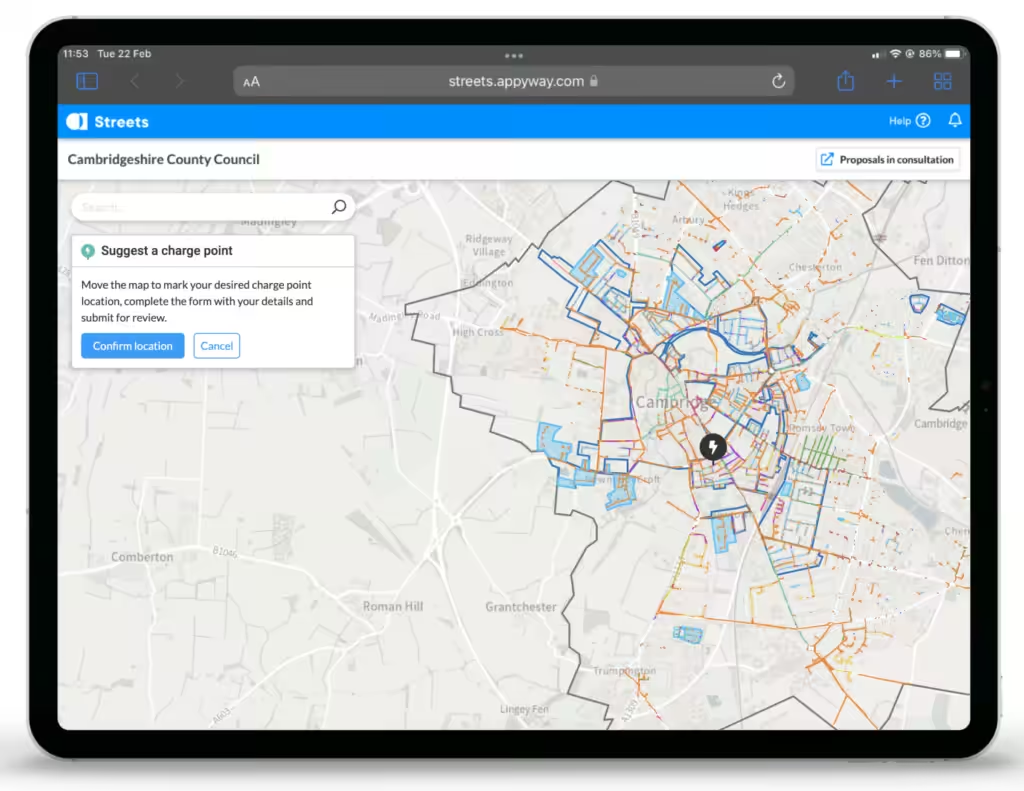
Request portal on iPad
”Situating chargepoints in the right places ahead of demand will inspire confidence in drivers who have not yet made the switch, thereby accelerating the uptake of EVs, which in turn will stimulate economic growth and support decarbonisation. The electricity network is adapting to support net zero and chargepoint rollout is part of this.
Planners need to be able to layer data and make location-based decisions, so we’ve made that really easy too. Using the Requests Tool, on our ever-growing Traffic Suite platform, you can layer geospatial data such as kerbside assets, including lampposts, substations and fibre cabinets. “Combine multiple datasets to understand chargepoint demand for a given area, pinpoint the most cost-effective locations and select which of these will best meet the needs of the community”. We help the local authorities and their chargepoint operator (CPO) to install the optimum number of EVCP’s, the correct type of chargepoint and in the right location. At the click of a button, you can easily export and share geospatial data too.