A member of
A member of


Digitise the rules of the road to power Climate-Neutral and Smart Cities
A trusted digital twin of your network does more than improve operations. It becomes the foundation for a more connected, efficient, and accessible city for your residents, businesses, and visitors.
Digitise the rules of the road to power Climate-Neutral and Smart Cities
A trusted digital twin of your network does more than improve operations. It becomes the foundation for a more connected, efficient, and accessible city for your residents and businesses.


For many cities, the road network is a complex and underutilised asset. Without a comprehensive, data-driven understanding, it is impossible to create effective policies for enforcement, future mobility, or sustainable revenue generation.

Our platform integrates your existing infrastructure into a federated digital twin ecosystem. This provides a single source of truth for parking and traffic management, ensuring every policy decision is backed by high-precision geospatial data.
Our platform integrates your existing infrastructure into a federated digital twin ecosystem. This provides a single source of truth for parking and traffic management, ensuring every policy decision is backed by high-precision geospatial data.
Accelerate the transition to Climate-Neutral and Smart Cities by automating complex processes. Our solution reduces operational costs by over 40%, enabling your team to focus on dynamic urban space allocation and impactful environmental outcomes.

From granular management of commercial loading zones to enabling seamless cashless payments, our platform helps you create sustainable revenue streams that residents are happy to use.

Modernise your network to support the prioritisation of public transport and active and shared mobility. Provide trusted, standardised kerb data that integrates with National Access Points and aligns with the European Mobility Data Space (EMDS)

We provide the "Digital Brain" for Europe’s Streets. Using AI and IoT, we enable dynamic urban space and kerbside allocation, helping cities move from static rules to responsive, climate-neutral operations
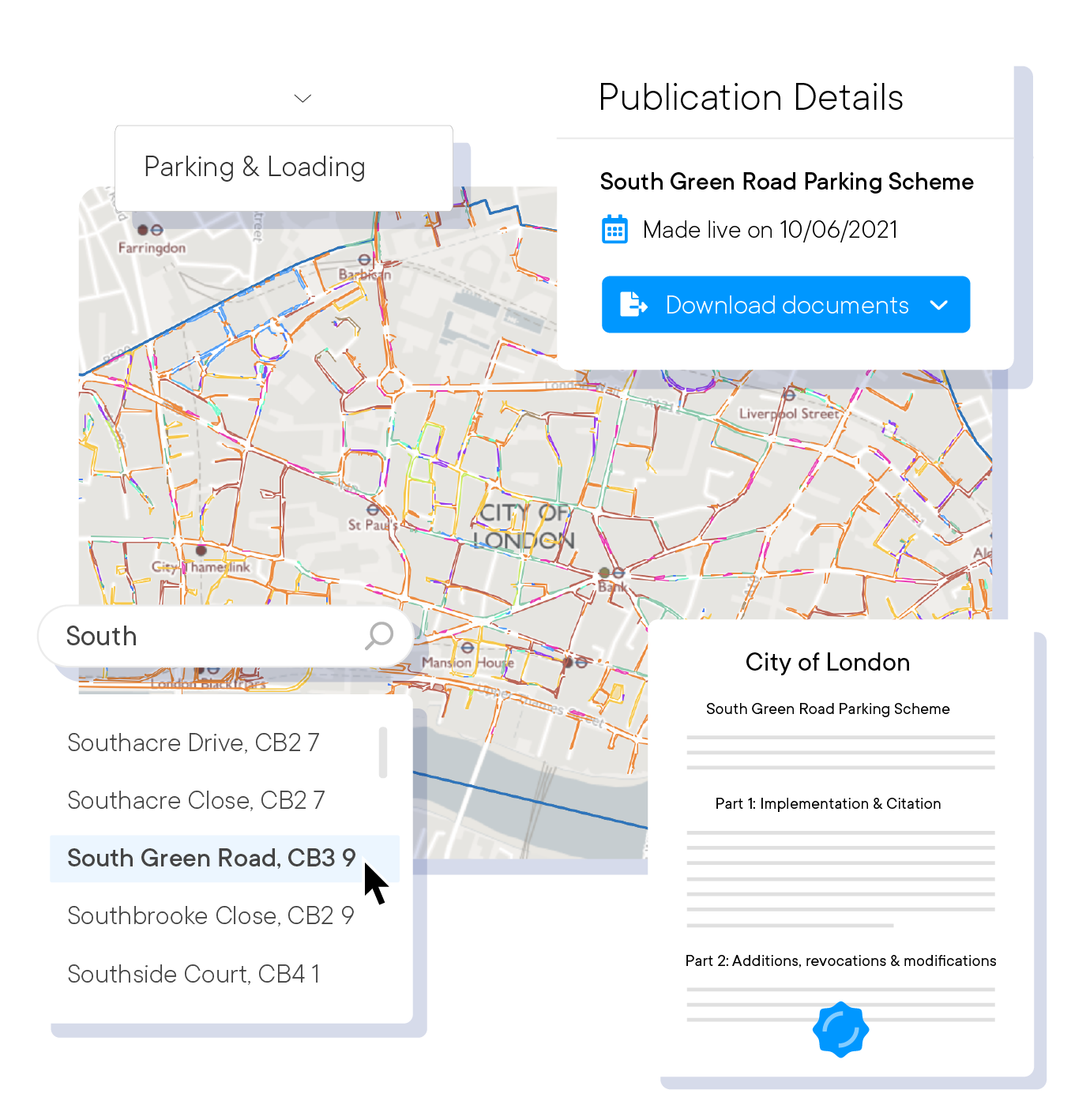
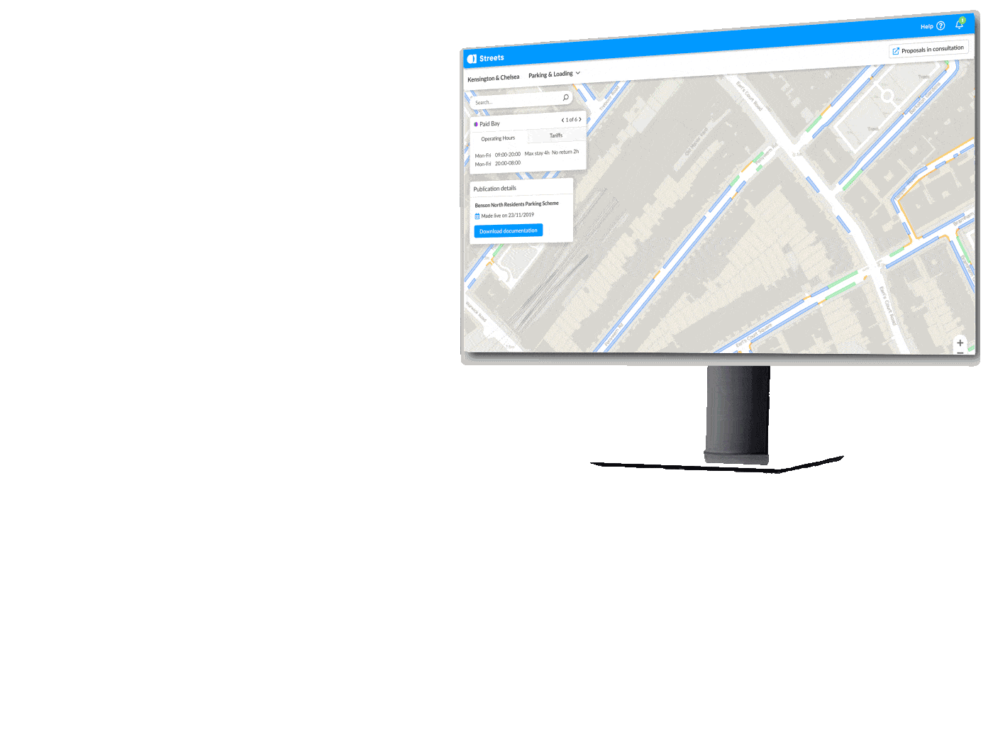
Transform your kerbside policies into machine-readable, geo-accurate data.
Eliminate manual processes with a single source of truth.
Visualise kerbside space availability by time of day and restriction type.
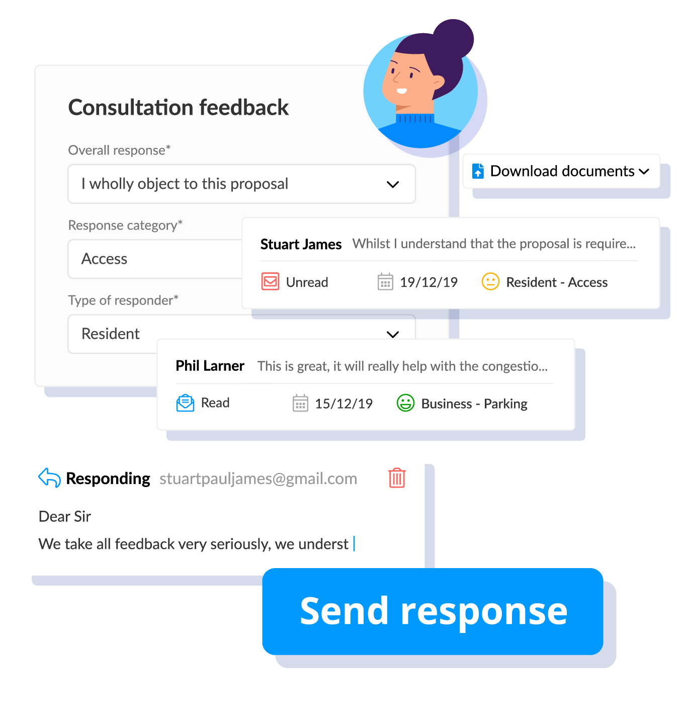
Use digital tools to consult with your local community on proposed changes, making planning more transparent and inclusive.
Allow residents to provide direct, location-based feedback to inform safer, more equitable street designs.
Turn weeks of manual consultation and mapping into hours, speeding up the implementation of new pilots and programmes.

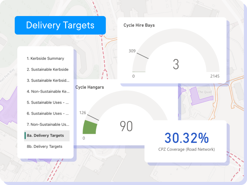
Use powerful analytics dashboards to understand kerb usage and support evidence-based policy-making.
Monitor the distribution of kerb innovations across neighbourhoods to ensure allocations are fair and equitable.
Use data to model the potential impacts of new policies, sustainability metrics, and mobility schemes before implementation.
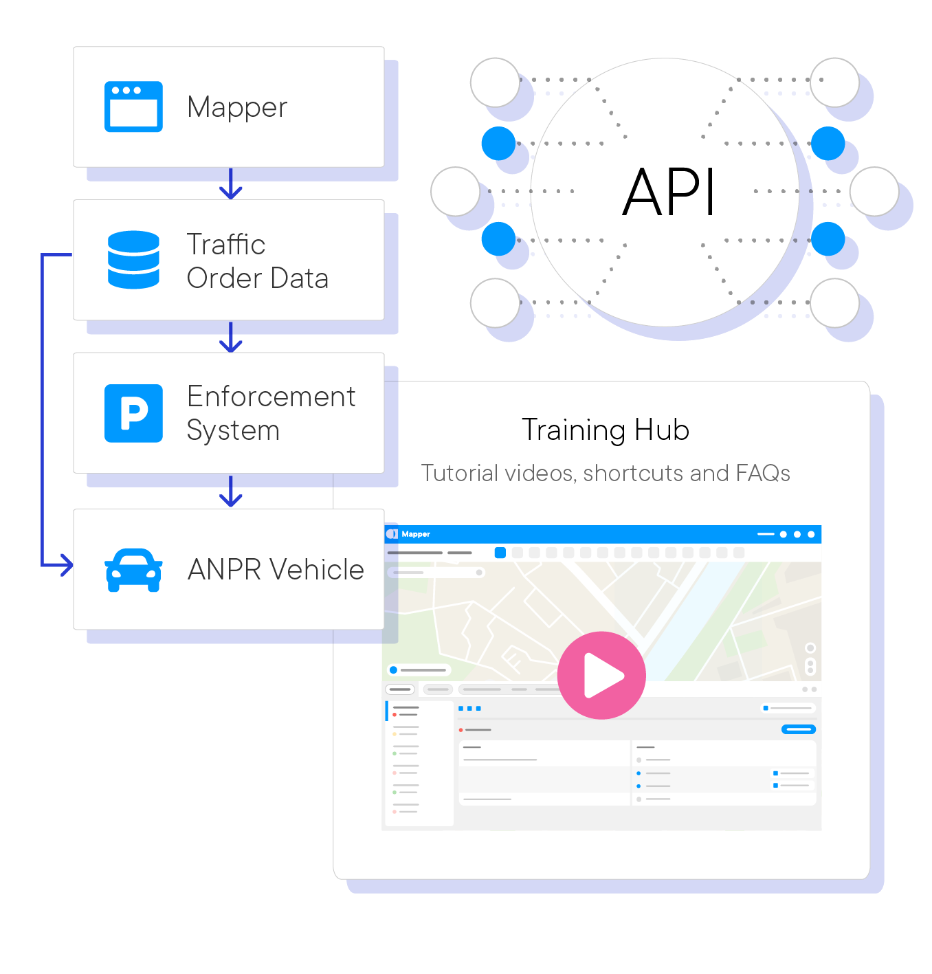
Provide seamless integration with your existing transport authority and GIS systems.
Enable third-party operators, logistics companies, and consumer navigation apps to access your rules, improving efficiency and regulatory compliance across the city.
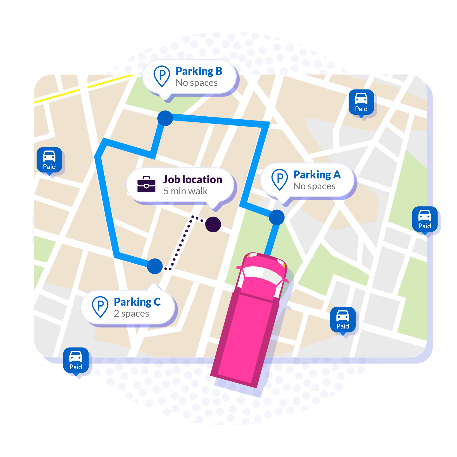
Link ANPR and enforcement cameras to our dynamic database to improve enforcement accuracy and ensure revenue protection.


Get in touch for a personalised demo with our kerb management specialists to see how it all connects.
Join an ever-growing number of forward-thinking local authorities who trust AppyWay:
![]()
Aldwych House,
71-91 Aldwych, London,
WC2B 4HN
© Copyright AppyWay. All Rights Reserved. Privacy Policy | Cookies Policy